An Introduction: Istanbul Walkabouts
This paper is about performing walks in currently transforming northern territories of Istanbul as a way of “getting lost,” and thus (un)learning the landscape by becoming a guest. As architects, landscape architects and urban planners; we are bound to think about the multitudinous intricate transformations taking place in today’s urban space. However, the idea of what is “urban space” has shifted immensely in the last few decades. The rapidly increasing scales of urbanization processes since the mid-20th century have made the dichotomy between “cities” and their “constitutive outsides” obsolete (Brenner & Schmid, 2012). Today, it is an indisputable fact that urbanization is a complex process not solely confined to cities because countrysides are not merely idyllic, stable landscapes outside dense urban areas. On the contrary, urbanization processes infiltrate into the rural realm in every part of the planet. Therefore, it is not possible to dismiss the transformations taking place in the peripheral areas of cities whose scales, velocities and intensities have increased in an incremental manner in the last decades. I, however, argue that most research focusing on Istanbul skips these areas that are located on the city’s outside. Moreover, in most urban research, sedentary and static methodologies that treat the researcher as an outsider is followed.
Therefore, with this paper, it is my aim to propose an alternative mode of urban research and knowledge production through the practice of walking. In order to do this, I will focus on the performative, projective and participatory walking research project Istanbul Walkabouts. This project investigates the ongoing operations taking place in northern territories of the city by walking along and around the route of the Northern Marmara Highway. I claim that looking at the transformations northern Istanbul is going through solely from the habituated approaches to space that is reduced to a god’s eye view perspective would eventually produce an incomplete understanding of this region. Many sensibilities relating to the region’s local history, ecology and even mythology would be lost through these modes of inquiry. Therefore, instead of using top-down research methodologies, Istanbul Walkabouts uses walking as a critical spatial practice (Rendell, 2007) and a creative method in order to explore, record, map and resist transforming landscapes of northern Istanbul. It has emerged during the process of a doctoral study[1] and piecemeal transformed into an independent walking research project. Since June 2018, I continue to perform these peregrinations around the highway as walks open to the public, free of charge.
I will start by giving a brief insight to Istanbul’s recent urban historiography and to the current mega-scaled operations taking place in northern Istanbul as they triggered me to start walking within these geographies. After that, I will illustrate the twofold concept of terra incognita that lies within Istanbul Walkabouts by highlighting that the walks are done in the less-frequented northern peripheries of Istanbul and also by underlining that walking methodology in itself is a less explored territory for urban research. To further emphasize this phenomenon, I will refer to Solnit and La Cecla’s interpretation of “getting lost” as a mode of transformation of the self by performing an unknown territory. In order to deepen this argument, I will open up the concept of walkabout to which the project also takes its title from. Later on, I will refer to why I see the walks as “expeditions to the near” by exemplifying a particular walk I have done as a part of Istanbul Walkabouts on November 2, 2016. This will finally bring me my argument of becoming a guest in northern Istanbul, in geographical and theoretical terms, by actually “getting lost” in it at first, only to “discover” it afterwards.
From Littoral Orientation to Ad Hoc Geo-urbanism
Like in the case of many other cities, highways have been rather determinant in the formation of Istanbul’s macroform. Typically, before industrialisation and the rural exodus that was triggered due to the effects of industrialisation, Istanbul’s macroform has been developed in accordance with its geography and topography. Even though, there have been major modernisation moves in the first half of the 20th century, the actual transformation in the city’s macroform took place with the initialisation of the transportation infrastructure projects in the last three decades of the century. Due to the construction of the suspension bridges built over the Bosphorus in 1973 and 1988 respectively, and their highways cutting through the city on an east-west trajectory, the medieval littoral orientation of Istanbul transformed into a highway orientation. The city grew towards north following the Bosphorus and along the east-west trajectory of the highways. Towards the end of the 20th century, the southern territories of the city became highly populated, industrialised and urbanized, while the northern territories constituted the green belt for Istanbul which was composed of village settlements, farms, agricultural fields, pastures, quarry lakes and nature areas like forests and water basins. This green belt contains the above and underground water reserves, increases the quality of air, alleviates the temperature rise caused by the urban heat island effect, and houses endemic plants and animals (Tema Vakfı, 2014). Since Istanbul is confined by Black Sea in the north, Sea of Marmara on the south and bisected by the Bosphorus Strait, there is no possibility of creating another space for nature areas. Thus, protecting this green belt always has the utmost importance for the city’s ecology.
After the turn of the 21st century, the processes of urbanisation taking place in Istanbul changed gear. One crucial reason for this was the 1999 Izmit earthquake whose devastating aftermath signalled that existing modes of urbanisation in this region had to change. Following this, the economic crisis of 2001 provided the grounds for a major political shift as well. AKP (Justice and Development Party) was formed during this crisis and won the majority of the votes in 2002 elections and formed the government. AKP saw the growth of the construction sector as a quick fix for the economy and Istanbul was chosen as the prime operational ground. In 2004, the administrative boundaries of Istanbul Metropolitan Area governed by Istanbul Metropolitan Municipality were increased from 1830 km2 to 5340 km2, which made Istanbul one of the largest metropolitan areas in the world (Turan, 2011; Istanbul Metropolitan Municipality, n.d.). With this change, the Metropolitan Municipality became the main authority for the peripheral areas that were formerly independently administered. In 2005, IMP (Istanbul Metropolitan Planning) was founded as a research unit within Istanbul Metropolitan Municipality (Url-1) and produced a 1:100.000 Spatial Development Plan for Istanbul, which was revised in 2009 (Istanbul Metropolitan Municipality, 2009). This master plan proposed that the extension of urbanisation was to continue on the southern belt of the city, whereas the forests and water basins in the northern green belt were to remain untouched. Most importantly, there was no proposal for a third highway and even though it was proposed, the third airport was situated in Silivri, a district on the coast of Sea of Marmara, not on the Black Sea coast (Istanbul Metropolitan Municipality, 2009). Considered as the city’s constitution at the time, this master plan clearly asserted that the processes of urbanisation including the infrastructural projects should be focused on the southern territories of the city while the northern territories should be protected so that the ecological corridors, flora and fauna, in other words, the existing ecosystem, will be kept intact.
Even though in the first decade of the 21st century, Istanbul witnessed colossal changes in processes of urbanisation, the neoliberal modes of urbanisation the city experienced after 2010 picked up pace and volume in a way that was implausible before. I refer to this period as “ad hoc geo-urbanism” (Tümerdem, 2014; Tümerdem, 2017; Tümerdem, 2018) which stands for the operational techniques used by the state in order to materialise its “mega” discourse implemented on the northern territories of the city. They serve as an easy way to sustain the country’s economic stability, however, at the expense of the city’s nature reserves. Geo-urbanism, or geographical urbanism, refers to the paradigm shift in modes of urbanization when it is no longer natural geography and topography that determines how cities will be formed, but the human activities at a colossal scale that actually mould the new geographies on the Earth’s surface (Katsikis, 2014). Accordingly, the term “ad hoc geo-urbanism”, deriving from geo-urbanism, intends to spotlight the particular urbanization processes taking place currently in northern Istanbul and Turkey at large. Thus, emphasis on geography is about the “geographical impact” of these operations that transform a territory by deleting its existing geography, topography, history and human and nonhuman inhabitants. The fact that these operations that violate the city’s official masterplan are nonetheless materialized for particular ends of certain actors while disregarding expert opinions and public benefit, make them “ad hoc” processes.
First of all, 2010 stands as a turning point in the city’s urbanisation since the planned construction of the Third Bosphorus Bridge in northern Istanbul was announced to the public in April 2010 (Url-2). This was only the start of the brutal transformation in the government’s urban discourse and the harbinger of large-scale, state-led operations that were to follow in northern Istanbul that was formerly delineated to be strictly protected by the 1:100.000 Spatial Development Plan. After the disclosure of the Third Bosphorus Bridge, the announcement of Northern Marmara Highway was made in 2011. Despite the fact that expert opinions presented viable reasons why Istanbul does not need another bridge (Gerçek, 2014) and oppositions held by NGOs and city’s dwellers, the highway and the bridge were built in 2016 anyhow (Url-3). Unsurprisingly, the highway is not solely a utilitarian and technical piece of transport infrastructure that transits the northern territories of the city in order to connect Asia to Europe over Bosphorus for the third time but acts as a major infrastructural spine to recently completed and forthcoming megaprojects. The construction of New Istanbul Airport, claimed to be the world’s largest as of date, was announced in 2011 and was completed in 2018 (Url-4). KOS (Northern Forests Defence), an independent movement formed to protect the northern forests, recently announced that even though the Environmental Impact Report published by the Ministry of Environment and Urbanisation had stated that only 2.5 million trees were going to be cut down to provide space for the construction of the highway and the airport, the actual number was in fact 13 million (Güvemli, 2019). This shows that official reports are neither credible nor sufficient in showing the detrimental effects these projects will have on the city and the region at large. On top of all this, the ecologically catastrophic Canal Istanbul was also announced to the public in 2011 as the “crazy project” by the then prime minister Recep Tayyip Erdoğan (Url-5). This canal will divide the western part of the city in two, create a second strait parallel to Bosphorus and thus connect the Sea of Marmara and the Black Sea for a second time which will then form an island out of western mainland. The alleged motive for building such a canal is to use it for the passage of tank ships and to prevent the immense calamity of an exploding oil tanker and its hazardous impacts on the shores of Bosphorus. Yet, the announcement of New Istanbul in 2011 as a new city that will be built around the recently privatized public lands along the route of Canal Istanbul beckons an ulterior motive that is directly linked to developing real estate projects in the region. (Url-6). In order to reflect upon how the practice of walking within ad hoc geo-urbanisms of northern Istanbul enables the understanding of an unknown geography and triggers alternative methodologies in urban research, I will now discuss the concept of a twofold terra incognita and illustrate in more detail how “getting lost” is in fact beneficial when investigating an unknown geography.
A Twofold Terra Incognita
“Look here, my friend,’ Don Quixote replied, ‘not all knights can be courtiers, and not all courtiers can or should be knights errant: the world needs both kinds, and even if we are all knights there is a very great difference between one sort and the other; because courtiers, without leaving their chambers or the confines of the court, stroll all over the world just by perusing a map, which does not cost them a penny or cause them to suffer any heat or cold, or hunger or thirst; but we, the true knights errant, exposed to the sun, to the cold, to the air, to the inclemencies of the heavens, by night and by day, on foot and on horseback, measure the whole earth with our own paces […]”
― Miguel de Cervantes Saavedra, Don Quixote
Before expanding on the concept of a twofold terra incognita, I believe it is necessary to address the motivational ground for Istanbul Walkabouts. The ongoing state-implemented mega discourse is predominantly focused on northern Istanbul which accommodates nature areas that are crucial for the city. Recently, this region became the operational landscape where these transformations could be observed and the construction of the Northern Marmara Highway acted as the initiator of the ad hoc turn this geography is experiencing. Therefore, Istanbul Walkabouts investigates these processes of urbanisation on northern territories of the city by specifically walking along and around the route of the highway. In this regard, I suggest that the main contribution of Istanbul Walkabouts is to introduce walking methodology, often used in mobile ethnographical research (Sheller & Urry, 2006) to architecture, landscape and urban studies. Unlike the sedentary methodologies and god’s eye view approaches employed in most research focusing on the (un)built environment that try to “stroll all over the world just by perusing a map” (Cervantes Saavedra, 2005 [1605], p. 492) like the courtiers Don Quixote is describing, Istanbul Walkabouts uses the body to measure the earth by browsing on its surface like a knight-errant[2] (Cervantes Saavedra, 1996 [1605]; Solnit, 2014). Just like a knight-errant going on a journey into the unknown and coming face to face with the perils and wonders of being on site, I claim that by conducting a walking research in northern territories of Istanbul, I, geographically and theoretically, saunter through a twofold terra incognita.
Firstly, northern Istanbul is geographically a terra incognita per se for people living in Istanbul. Essentially, most areas in the region have not been a part of the Metropolitan Municipality until 2004. Accordingly, they have been perceived as the “outside” of the city. Moreover, even though they are approximately situated 30 kilometres away from the historical peninsula, it takes up to 2 to 3 hours to reach to one of the village settlements in the area due to the limited amount of public transportation. Thus, even though they are not far away in terms of distance, they are far away in terms of access. They are not on the daily route of commuters, nor have a specific symbolic importance for most people. Even though people are aware of the ongoing transformations in the area, the reactions are confined to small groups or movements that cannot multiply. Sadly, they stay out of mind because they are out of sight. Besides, the focus of most research that concentrates on Istanbul is usually the historical parts of the city or the populated, urbanised and industrialised areas and peripheral regions that are directly connected to the urban centres. Therefore, from the perspective of city-centric urban studies, which are naturally anthropo-centric as well, these areas have been mostly left out as they were considered to be “rural” areas beyond the urban realm.
Secondly, I consider adapting walking research, a methodology generally used in geography, anthropology, ethnography and artistic practices, to a research conducted in architectural design as a theoretical terra incognita. It is an undeniable fact that the practice of walking in the city has been elaborated often in the fields of architectural and urban research at large. Benjamin’s flâneur (1983), de Certeau’s Wandersmänner (1988), Jacobs’ sidewalk ballet (1961) are paramount references that have been cited innumerable times. Yet, they deal with a specifically “urban” context. Therefore, using walking as a method to investigate city’s rural hinterlands is rather an unexplored area within design disciplines. Thus, instead of being confined to maps, satellite images and plan drawings, and seeing the world through someone else’s representation, with Istanbul Walkabouts, I propose to leave behind our sedentary and godly positions in the studio, at the desk and in front of the screen and go outside. My argument is that by browsing these uncharted territories and focusing to the non-urban and non-human, by performing its topography and participating in the spacetime transformations of this landscape, it becomes possible to shift the lens of current research focusing on Istanbul and thus learn about the city not through dichotomies of urban and rural but through a much richer and complex understanding. In this context, I want to follow Solnit and La Cecla’s interpretation of “getting lost” in a landscape in order to truly know it and be transformed by it and, later on, examine how the concept of walkabout relates to Istanbul Walkabouts.
Learning to Get Lost
“Not to find one's way around a city does not mean much. But to lose one's way in a city, as one loses one's way in a forest, requires some schooling. Street names must speak to the urban wanderer like the snapping of dry twigs, and little streets in the heart of the city must reflect the times of day, for him, as clearly as a mountain valley. This art I acquired rather late in life; it fulfilled a dream, of which the first traces were labyrinths on the blotting papers in my school notebooks.”
― Walter Benjamin, Berlin Childhood around 1900
With the idea of walking in a geographical and theoretical terra incognita taken as the starting point, I want to argue that the transition from incognita to cognita can only be possible through “getting lost”. In order to chart unknown territories and make them known to one’s self, one initially has to get lost in them. Solnit separates the concept of lost into two dissimilar meanings. One is about losing things, and it happens when the familiar recedes, whereas the other one is about getting lost, in which the unfamiliar appears in front of you and you accept to be enmeshed within it (2006). To emphasize the latter meaning of getting lost, she even quotes Keats’s concept of “negative capability” in which the poet comments that a Man of Achievement is “capable of being in uncertainties, Mysteries, doubts, without any irritable reaching after fact and reason” (Keats, 2005). She also comments that lost is “a state of mind,” even a potency that allows one to welcome the unforeseen and be “at home in the unknown” (Solnit, 2006). Therefore “getting lost” is not taken as a pejorative state but on the contrary a favourable experience.
In this sense, I believe it is also crucial to open up the concept of walkabout and expound upon how it relates to Istanbul Walkabouts. Walkabout is a journey made on foot that can last for weeks, months or even years (Chatwin, 1987). The concept belongs to the Indigenous Australian culture and it is considered to be a rite of passage based on the state of being temporarily mobile. Usually done by men, it symbolizes the passage to adulthood where the one who goes on walkabout and returns back, proves that he can survive alone out there in the wild. He can read the signs left on the Earth’s surface, natural or manmade and find his way across the desertic landscape of Australia (Careri, 2002; Chatwin, 1987). However, while on this spiritual trek, the Aboriginals do not wander around aimlessly or without a map. On the contrary, the whole continent is enlaced by songlines or dreaming tracks. Songlines are the “labyrinth of invisible pathways which meander all over Australia,” (Chatwin, 1987) and according to Aboriginals, they are formed by their ancestors as they roamed the continent tirelessly in a dream state for thousands of years and sung every living and non-living thing to creation (Careri, 2002; Chatwin, 1987). The knowledge of the songlines, in other words, the oral map of the whole continent, is transferred from generation to generation in the form of songs. Each track has its own song and each tribe knows the songs that belong to their territory. By knowing the song, you know your his/herstory and can navigate on this arid landscape, find food, water and shelter, and thus survive. When a certain tribe’s territory ends, the language of the song changes, but its melody stays the same. This means that the one who can “hum the right tune” (Chatwin, 1987), can also find his way across the whole continent.
I believe that there is a connection between the concept of the walkabout and Solnit and La Cecla’s description of “getting lost”. Going on walkabout is going on a journey to get lost, only to find one’s self again and come back transformed. Solnit describes getting lost as ceasing “to be lost not by returning but by turning into something else” (Solnit, 2006). She denotes that the early explorers of the Americas who went on long expeditions to the unknown lands of the New World, would become homesick at first. They would feel alienated towards their new surroundings and be estranged about what these surroundings contained. Initially, they would stagger in adapting. Yet, in time they would start getting used to this new environment. It would be like they were learning a new language and they would transform from being a stutterer to being a fluent speaker in this language (Solnit, 2006). La Cecla associates it with growing up and asserts that getting lost is about “learning how to get oriented by oneself, and to need no guide to leave behind the meanders and the pitfalls of the surrounding environment” (La Cecla, 2000).
This is quite similar to Chatwin’s description of territory. He states that territory is a “place in which you stay… where you know every nook and cranny…where you know by heart every refuge…” (Chatwin, 1987). Before the walkabout, before having that experience, you actually do not know the landscape. However, by going on walkabout, you learn the songs of the landscape and become fluent in them, you master a vast territory inside out. In fact, with the songlines that weaved all over the continent, a “totemic geography” was created. However, this oral map on a continental scale was not about the acquisition of an unvanquished land or conquest of a certain space. On the contrary, for the animist Aboriginals, the earth must remain unscarred and untouched because hurting the earth is the same as hurting yourself. Their idea of browsing the land was not about making changes, it was about lightly walking over it, eating and drinking that was enough for their survival and leaving only footprints. In return, they would give harmless sacrifices like slitting a vein in their forearm and sprinkling their own blood on the soil which was a way of thanking the earth for its gifts (Chatwin, 1987). In the end, while the Earth’s crust was transformed somewhat lightly, the walker changed completely. By roaming the face of the earth, the walker also became a part of the songline, a part of the oral history. For Solnit, “getting lost” is a mode of being. By going on expeditions to foreign lands, by being open to the risk of losing yourself, you welcome the probability of transforming into something else. La Cecla’s association of getting lost with growing up reinforces Solnit’s claim. The walkabout, an animistic rite of passage, is also about going towards the unknown and learning your territory and yourself through this experience. In this vein, my claim is that Istanbul Walkabouts is also about going on expeditions to the unknown. Only by exposing yourself to this foreign landscape, it becomes possible to truly know it. Naturally, after these expeditions to the near, one transforms together with the landscape as well.
The Expeditions
After performing more than a dozen of walks for Istanbul Walkabouts in areas that were a part of Istanbul but were certainly another realm in itself, I started referring to these walks as “expeditions to the near”. For these walks, we took long commutes in order to reach the area and then we roamed in this landscape for hours in order to learn things we could not have otherwise. We stuttered at first for we did not know where we were walking and how to even walk there. Yet, in time, we got more fluent in our walks. During this process, I have also learned that the roots of the word sefer, which means expedition in Turkish and comes originally from Arabic, can throw a light to how Istanbul Walkabouts relates to idea of “getting lost”. Sefer, or safar in its original pronunciation in Arabic, means “a long walk, journey”. Its roots go back to Aramiac and Akkadian with connotations that indicate “leaving a foot print, making a path, drawing a border” (Nişanyan Sözlük, n.d.). Thus, going on an expedition is actually going on a long journey afoot, leaving your footprints on the land, creating a path, drawing a border, drawing on the face of the Earth, getting lost and being found. Later on, I had another revelatory realization about the Swahili word safari, which was universalized in the 19th century (Online Etymology Dictionary, n.d.) and used in many languages to denote a journey made for trophy hunting, or more politely, to observe wildlife. Actually, in Swahili language, safari means “journey” and it comes from the Arabic word safar as well (Nişanyan Sözlük, n.d.; Online Etymology Dictionary, n.d.).
Abandoning the known territory of maps, drawings, satellite images, and leaving behind the urbanized centres, hence generalized theories and concepts on the urban, I wended forth to a part of Istanbul that was unbeknownst to me in order to pursue a methodology that I was not familiar with. With these exploratory expeditions I made to northern Istanbul, I learned to be “at home in the unknown” – both in terms of geography and in terms of theory. In the early walks, I was accompanied by one or two persons and walked short distances. There was no particular plan on how or where to walk. The walks started from a village settlement around the highway that could be reached by public transportation, and lasted for a few hours until we reached another village settlement nearby from where we could commute back with public transportation. The main idea was to connect two settlements and encounter the highway one way or the other. Prior to walking, I looked at satellite images in order to have a certain idea about the area, but unsurprisingly, map is not the territory and the route that was planned on the map was always very different than the route we actually took on the ground.
To further illustrate how the walks allowed us to learn how to get lost in the unfamiliar, I have chosen one particular walk performed on November 2, 2016 from Anadolufeneri to Poyrazköy. For this walk, we roamed 6.2 kilometres in north Anatolian part of Istanbul for 2 hours and 20 minutes. Considering that the average walking speed for humans is 5 km/h, the distance travelled shows that we were actually “lost”. Anadolufeneri is a very small fishermen’s village situated on a small peninsula right at the confluence of the Bosphorus and the Black Sea. By virtue of its position, there is a lighthouse on the promontory which gives the village its name. Anadolufeneri means “lighthouse of Anatolia”. Poyrazköy is another fishermen’s village located at the northern end of the Bosphorus. Being situated on a protected bay, Poyrazköy also has a port of its own. Since the piers of the Third Bosphorus Bridge have been built here, the prospect of the village has changed. We have observed the current situation of this area and the impacts of the highway very closely during the walk:
When we reach a junction, we choose the path towards the bottom of the valley instead of following the paved road. Along this path are agricultural fields and several private houses. [1 km; 59 m; 13:59] As we move further, we also see some prefabricated cabins and some basic concrete structures that are most probably used by the owners of agricultural fields. There are some stone walls and some hybrid fences made with existing tree branches and some iron rods. We notice some cattle and ovine tracks on the dirt road. After a while, the agricultural fields diminish from sight and we start hearing the highway hum. A small dried up stream at the bottom of the valley appears and both sides of the valley are covered with thick forest. At this point, the piers of the viaduct emerge as well. [V21] It is a significant experience to walk in a dirt road or a path surrounded by agricultural fields, prairie, brambles and forest trees and barge into colossal viaducts, columns and plates. Again, from picturesque landscapes where one thinks ‘Am I really in Istanbul?’ to Ballardian formations where a feeling of extreme concern takes over.
Walk 6 × Anadolufeneri – Poyrazköy, (Tümerdem, 2018)
Slowly, obstacles that could not have been foreseen via mapping tools start showing up:
When we start seeing the highway from afar, physical barriers also start showing up. There was a small part with thorny brambles and bunch of branches that seemed to be placed there by someone(s). We somehow traverse this barrier, but it is not possible to overpass the embankment reaching up to the highway. We walk back on the same path and enter a more plain-like area by crossing over a fence that surrounds it. Obviously, someone uses this plain as we see some crops. The area is also surrounded by metal and wooden fences that form a border with the forest. [3 km; 38 m; 14:57] The only possibilities we have are to walk all the way back or skirt the highway by traversing the forest and making a ‘shortcut’ until we reach the next walkable path or road. We choose the latter option. After finding a bilateral wooden step, we enter the forest.
Walk 6 × Anadolufeneri – Poyrazköy, (Tümerdem, 2018)
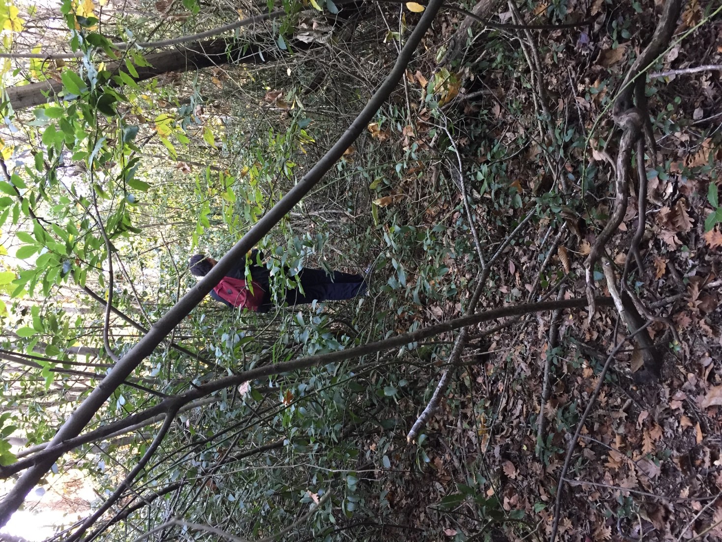
Trying to find one’s way in the forest is not easy. We are utterly enmeshed within the dense trees and bramble that cover most of the forest ground that we feel completely isolated from the surroundings. We do not have a reference point so it is rather hard to orient one’s self:
The forest is very thick and full of thorny brambles. Naturally, there are no paths or very vague ones that had not been used for a very long time. We continue walking towards where it feels easiest to traverse. The walk through the forest is about 500 metres, yet it lasts around 45 minutes. The forest is so thick that our phones loses their signal almost the entire time while we are inside the forest. The brambles make walking very hard. The thorns snag on our clothes and even scratch our skin. [...] After a while though, even though we cannot see it, we start hearing the highway humming so we know we are on the right track. This is the hardest part of the whole walk and our average pace decreases to 1,6 km/h. Only after we exit the forest and come to Anadolufeneri Road, we spot the highway and the Third Bosphorus Bridge. [4 km; 104 m; 15:34]
Walk 6 × Anadolufeneri – Poyrazköy, (Tümerdem, 2018)
As we entered deep into the forest, we did not only get lost in physical space, but we also got lost in digital space as our phones lost receiving any signal. We were engulfed by thick bramble that covered the forest ground. It was hard to proceed but it was easy to get disoriented. However, due to this mishap, all that we could do was trust our senses. We had to follow our instincts and find our way out of the forest. Eventually, by prioritizing senses like hearing over seeing, and trusting the agency of the body to put one step after the other, we managed to get out of the jungle. We could have only achieved this primal state of orienting ourselves in the landscape after we were utterly lost in it.
This was one of the first walks I have performed for Istanbul Walkabouts on the northern territories of Istanbul and it acted as an initial practice for learning how to get lost. I had one walking companion with me and we assisted each other throughout the walk. Gradually, after making more and more walks, I also started becoming familiar with being in the unknown. As the walks spread with word-of-mouth, the number of participants started to increase. Being situated at the hinterland of city’s urban centres, the northern territories were terra incognita regions for me as a person born and raised in Istanbul and for many others who participated in the walks since 2016. Wandering in these foreign territories was like going on an exploratory expedition in a new continent. For every walk, we commuted for few hours to the starting point of our route and then we started drifting in the landscape. The weather conditions were new, the topography was different than what we were used to in urban areas, the flora and fauna was rich and unfamiliar.
A Conclusion: Becoming a Guest
With this paper, I intended to spotlight the walking project Istanbul Walkabouts which was formed as a reaction to the ongoing transformations taking place in northern Istanbul. I have emphasized how I take getting lost in these operational landscapes as a mode of (un)learning about this area. This (un)learning happens when you are not convinced with what is given to you with the maps but you go to the site to verify it. You create your own knowledge, your personal maps. In my etymological endeavours, I have also found out that the word misafir, meaning guest in Turkish and again coming from the Arabic word musafir, implies a person who is on an expedition, an expeditioner. Naturally, it has the same root with safar which means “a long walk, journey” as previously revealed. (Nişanyan Sözlük, n.d.). I believe this word holds the connection between the walkabouts that I perform and the idea of “getting lost”. Initially, a guest is an errant person who is on a journey and stays at a place temporarily. Guests are strangers in a place unbeknownst to them. Nonetheless, this unfamiliar place is in fact someone else’s home. The guests come there temporarily and they are expected to show courtesy. They do not request or command but comply and accept. Yet, they can still make themselves “at home in the unknown” (Solnit, 2006). For La Cecla, a “stranger” is a person who knows that she “must be accepted by the hospitality of the inhabitants and is aware of the risks of his or her anomalous identity. Those who don’t play the role of the stranger are “tourists”, destroyers” (La Cecla, 2000). On the other hand, when you go to a place as a guest, when someone welcomes you to their home, you momentarily enter to their lives and get an insight of how they live. You become a temporary inhabitant of that place. This means that there is a reciprocity in welcoming the unknown – the guest ventures into the unknown while the host also takes a risk by receiving the unknown.
In this sense, the state of becoming a guest can also be understood in terms of geography and theory respectively. Initially, becoming a guest geographically is about wandering on the terrain. From the two-dimensional map-territory that has no possibility of mutuality, we move to a three-dimensional territory and roam the face of the earth. There were no defined walking tracks, at least none that we knew of, but we did not “reject the unfamiliar but embraced it, in the course of which it became the familiar (Solnit, 2006). Thus, we slowly created our own routes within this landscape. Thus, by going on expeditions to northern Istanbul, we become guests to these “out of sight” territories and to their human and nonhuman inhabitants. We are guests who walk to explore, record and suture a geography dissected with the highway and transfigured through the implementation of mega-scaled infrastructural projects plunked from above. We are guests who are open to get lost in its forests and chant its songs. We are guests who do not want to become destroyer “tourists” in these territories but be transformed through the experience of walking through them as we become a part of them.
Consecutively, becoming a guest is also a more of wandering/wondering within theory in which the researcher leaves the familiar but sedentary methodologies behind and entering the unknown territory of an errant method that is active, performative and experiential. Then, the purpose of these walks is to formulate a programmatic proposition that questions traditional modes of knowledge production, bring forth the multiple scales, human and nonhuman lives and living and non-living subjects that has been mostly ignored and put the body into interaction with the site. After walking for hundreds of kilometres, having multiple encounters and experiencing this territory in varying seasons, weather, time of day etc. we piecemeal start constituting a methodology that can be followed in any research conducted in the disciplines of architecture, landscape architecture and urbanism in any city or geography.
In this regard, I believe Istanbul Walkabouts is offering an interpretation of the concept of walkabout as every route can be seen as a songline of northern Istanbul. We go to these uncharted territories and tread in their unknown landscapes. We become tired, we get thirsty, we get hungry. We scratch our bodies and shed some blood. Yet, we do not see this territory as a conquerable land that can be colonized, defined and represented in order to be urbanised. We do not want to change it but we become changed by getting lost inside it. With each route, we chant the songs of the landscape, we find out where can and cannot be walked. We (un)learn how to walk on the territory, we become familiar with the signs of the landscape, we memorize every “nook and cranny”, we walk with human and nonhuman others, we overcome obstacles and grasp how to orient ourselves in this territory. Eventually, as Benjamin says, we learn how to lose our way (Benjamin, 2004), we figure out how to utterly get lost.
Bibliography
Benjamin, W. (1983). Charles Baudelaire. A Lyric Poet in the Era of High Capitalism. London: Verso Books.
Benjamin, W. (2004). Bin Dokuz Yüzlerin Başında Berlin'de Çocukluk. Istanbul: YKY.
Brenner, N., & Schmid, C. (2012). Planetary Urbanisation. In M. Gandy, Urban Constellations (pp. 10-13). Berlin: Jovis.
Careri, F. (2002). Walkscapes: Walking as an Aesthetic Practice. Barcelona: Gustavo Gili.
Cervantes Saavedra, M. d. (1605 (2005)). The adventures of Don Quixote de la Mancha. London: Vintage.
Chatwin, B. (1987). The Songlines. London: Vintage Books.
Cronon, W. (1992). Nature's Metropolis: Chicago and the Great West. W. W. Norton & Company.
De Certeau, M. (1988). The Practice of Everyday Life. University of California Press.
Güvemli, Ö. (2019, June 22). 3. Havalimanı için 13 milyon ağaç kesilmiş. Retrieved July 2019, from https://www.sozcu.com.tr/2019/gundem/3-havalimani-icin-13-milyon-agac-kesilmis-5191955/
Gerçek, H. (2014). Transportation Planning and Big Transportation Projects in Istanbul. The Case of Beyoğlu, Istanbul Dimensions of Urban Redevelopment. (G. S. Erkut, Ed.) Berlin: Technische Universität Berlin. Retrieved September 2014, from Urban Management: https://www.urbanmanagement.tuberlin.de/fileadmin/f6_urbanmanagement/Study_Course/student_work/UM-Report_istanbul.pdf
Istanbul Metropolitan Municipality. (2009). 1 / 100.000 Ölçekli İstanbul Çevre Düzeni Planı. Retrieved September 2014, from Istanbul Büyükşehir Belediyesi: http://www.ibb.gov.tr/tr-TR/kurumsal/Birimler/SehirPlanlamaMd/Documents/100.000%20%C3%96l%C3%A7ekli%20%C3%87evre%20D%C3%BCzeni%20Plan%C4%B1%20Y%C3%B6netici%20%C3%B6zeti%20raporu.pdf
Istanbul Metropolitan Municipality. (n.d.). Yetki Alanı. Retrieved June 2019, from Istanbul Büyükşehir Belediyesi: https://www.ibb.istanbul/SitePage/Index/82
Jacobs, J. (1961). The Death and Life of Great American Cities. New York: Randon House.
Katsikis, N. (2014). On the Geographical Organization of World Urbanization. MONU, 20(Spring), 4-11.
Keats, J. (2005). Selected Letters of John Keats. (G. F. Scott, Ed.) Cambridge: Harvard University Press.
La Cecla, F. (2000). Getting Lost and the Localized Mind. In A. Read, Architecturally Speaking: Practices of Art, Architecture, and the Everyday (pp. 31-48). London: Routledge.
Nişanyan Sözlük. (n.d.). Nişanyan Sözlük. Retrieved from Nişanyan Sözlük: http://www.nisanyansozluk.com/
Online Etymology Dictionary. (n.d.). method. Retrieved August 2018, from Online Etymology Dictionary: https://www.etymonline.com/word/method
Rendell, J. (2007). Site-Writing: Enigma and Embellishment. In J. Rendell, J. Hill, M. Fraser, & M. Dorrian (Eds.), Critical Architecture (pp. 150-162). New York: Routledge.
Sheller, M., & Urry, J. (2006). The new mobilities paradigm. Environment and Planning A, 38(2), 207-226.
Solnit, R. (2006). A Field Guide to Getting Lost. Edinburgh: Canongate.
Solnit, R. (2014). Wanderlust: A History of Walking. London: Verso.
Stengers, I. (2005). The Cosmopolitical Proposal. In B. Latour, , & P. Weibell, Making Things Public: Atmospheres of Democracy (pp. 994-1003). Cambridge, MA: MIT Press.
Stengers, I. (2013). Another science is possible: a manifesto for slow science. Cambridge: Polity Press.
Tümerdem, N. (2014). A Case Study of the Third Bridge: An Exploration of the Impacts of the Transportation Infrastructure on the City’s Geography. EURAU Composite Cities (pp. 116:001-116:007). Istanbul: European Symposium on Research in Architecture and Urban Design.
Tümerdem, N. (2017). Ad Hoc Geo-Urbanism: An Exploration of the Impacts of the Third Bosphorus Bridge on the City's Geography. In G. Sağlamer, M. Aksoy, F. Erkök, N. Paker, & P. Dursun Çebi, Rethinking, Reinterpreting and Restructuring Composite Cities (pp. 269-279). Newcastle upon Tyne: Cambridge Scholars Publishing.
Tümerdem, N. (2018). Istanbul Walkabouts: A Critical Walking Research of Northern Istanbul. Unpublished doctoral dissertation, Istanbul Technical University, Department of Archtiecture, Istanbul.
Tümerdem, N. (forthcoming). The School of Site: Istanbul Walkabouts. Journal of Public Pedagogies.
Tema Vakfı. (2014). İstanbul'un Geleceğini Etkileyecek Üç Proje: 3. Köprü, 3. Havalimanı, Kanal İstanbul. İstanbul: Atölye Omsan.
Turan, N. (2011). Towards an Ecological Urbanism for Istanbul. In A. Sorebsen, & J. Okata, Megacities: Urban Form, Governance, and Sustainability (pp. 223-243). Tokyo: Springer.
Url-1. (n.d.). Retrieved from https://bimtas.istanbul/
Url-2. (n.d.). Retrieved from http://megaprojeleristanbul.com/#3-bogaz-koprusu
Url-3. (n.d.). Retrieved from http://megaprojeleristanbul.com/#kuzey-marmara-otoyolu
Url-4. (n.d.). Retrieved September 2014, from http://www.megaprojeleristanbul.com/#3-havalimani
Url-5. (n.d.). Retrieved September 2014, from http://megaprojeleristanbul.com/#kanal-istanbul
Url-6. (n.d.). Retrieved September 2014, from http://www.megaprojeleristanbul.com/#yeni-istanbul-projesi
[1] Istanbul Walkabouts is a still ongoing walking project that was formed as a spin-off to my doctoral dissertation entitled Istanbul Walkabouts: Critical Walking in Northern Istanbul completed in 2018 in Architectural Design Programme of Istanbul Technical University under the supervision of Prof. Arzu Erdem.
[2] I would like to thank my friend Aytaç Fener for reminding me of Don Quixote’s distinction between the courtier and the knight-errant in Cervantes’s great masterpiece.